
AutoCAD Civil 3D Essentials - Training Course
Master AutoCAD Civil 3D at ETC Lebanon. Learn essential skills in surveying, surface modeling, alignments, corridors, grading, and civil project design through professional hands-on training.
Duration: 30 hours
Teaching Methodology: Hands-on
Course Schedule: Schedule
Fees: $450
Course Mode: Blended - Face-to-face or online via Zoom
 |
 |
 |
 |
DESCRIPTION
This AutoCAD Civil 3D course teaches you about the survey workflow, points, linework, surfaces, project management, alignments, profiles, assemblies, corridors, grading, pipe networks, plan production, quantity take-offs, and visualizations.
AUDIENCE
Civil engineers, designers, drafters, technicians, and surveyors.
PREREQUISITES
Experience with AutoCAD or AutoCAD-based products (such as Autodesk Land Desktop) and a sound understanding and knowledge of civil engineering terminology.
COURSE CONTENTS
01 - AutoCAD Civil 3D Interface
- Product Overview
- AutoCAD Civil 3D Workspaces
- AutoCAD Civil 3D User Interface
- AutoCAD Civil 3D Toolspace
- AutoCAD Civil 3D Panorama
- AutoCAD Civil 3D Templates, Settings, and Styles
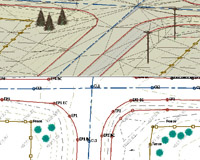
02 - Survey, Points, and Linework
- Survey Workflow
- Creating Figure Prefixes
- Styles
- Points
- Point Marker Styles
- Point Settings
- Creating Points
- Creating Civil 3D Points
- Key Sets
- Creating a Description Key Set
- Importing Survey Data
- Reviewing and Editing Points
- Point Reports
- Manipulating Points and Point Reports
- Point Groups
- Creating Point Groups
- Lines and Curves
- Subdivision Project
03 - Surfaces
- Surface Process
- Surface Properties
- Contour Data
- Other Surface Data
- Creating an Existing Ground Surface
- Breaklines and Boundaries
- Surface Analysis Tools
- Surface Editing
- Adjusting Surfaces through Surface Properties
- Viewing Surfaces in 3D
- Surface Labels
- Surface Volume Calculations
- Surface Analysis Display
04 - Project Management
- Design Development
- Templates
- Managing Styles
- Styles in-Depth
- Online Maps Service
- Civil 3D Styles
- Civil 3D Projects
- Sharing Data
- Using Data Shortcuts for Project Management
- Starting a Project
- Manage File Sizes
05 - Alignments
- Roadway Design Overview
- Civil 3D Sites
- Introduction to Alignments
- Creating Alignments from Objects
- Alignment Layout Tools
- Creating and Modifying Alignments
- Alignment Properties
- Labels and Tables
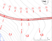
06 - Profiles
- Profiles Overview
- Create a Profile View Style
- Create Profiles from Surface
- Create Profile View Wizard
- Working with Profiles
- Finished Ground Profiles
- Create and Edit Profiles
07 - Assemblies
- Assembly Overview
- Modifying Assemblies
- Creating Assemblies
- Managing Assemblies
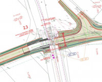
08 - Corridors
- Creating a Corridor
- Corridor Properties
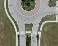
- Designing Intersections
- Roundabouts
- Corridor Section Review and Edit
- Corridor Surfaces
- Sample Line Groups
- Section Volume Calculations
- Compute Materials
09 - Grading
- Grading Overview
- Feature Lines
- Create Design Surfaces from Feature Lines
- Create the Interim Design Surface
- Grading Tools
- Modifying Grading
10 - Pipe Networks
- Pipes Overview
- Pipes Configuration
- Creating Networks from Objects
- The Network Layout Toolbar
- Networks Editing
- Annotating Pipe Networks
- Pressure Pipe Networks
11 - Plan Production
- Final Design
- Plan Production Tools
- Plan Production Objects
- Plan Production Object Edits
- Plan Production Tools
- Creating Sheets
- Section Views
- Sheet Sets
12 - Quantity Takeoff and Visualization
- Multi-view Blocks
- Adding Details
- Pay Items
- Quantity Takeoff
- Visualization
- 3D Navigation Tools
- Managing Views
- Corridor Visualization
- Share