AutoCAD Civil 3D-Essentials

AutoCAD Civil 3D - Essentials

Duration: 24 hours

Teaching Methodology: Hands on

Course Schedule: Schedule

Fees $350

Course Mode: Blended Face-to-face or online via Zoom


DESCRIPTION

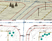
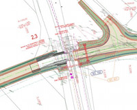
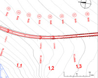
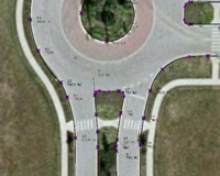
This AutoCAD Civil 3D course teaches you about the survey workflow, points, linework, surfaces, project management, alignments, profiles, assemblies, corridors, grading, pipe networks, plan production, quantity take-offs, and visualizations.

AUDIENCE

Civil engineers, designers, drafters, technicians, and surveyors.

PREREQUISITES

Experience with AutoCAD or AutoCAD-based products (such as Autodesk Land Desktop) and a sound understanding and knowledge of civil engineering terminology.

AutoCAD Civil 3D 01
AutoCAD Civil 3D 02
AutoCAD Civil 3D 03
AutoCAD Civil 3D 04

COURSE CONTENTS

01 - AutoCAD Civil 3D Interface

  • Product Overview
  • AutoCAD Civil 3D Workspaces
  • AutoCAD Civil 3D User Interface
  • AutoCAD Civil 3D Toolspace
  • AutoCAD Civil 3D Panorama
  • AutoCAD Civil 3D Templates, Settings, and Styles

02 - Survey, Points, and Linework

  • Survey Workflow
  • Creating Figure Prefixes
  • Styles
  • Points
  • Point Marker Styles
  • Point Settings
  • Creating Points
  • Creating Civil 3D Points
  • Key Sets
  • Creating a Description Key Set
  • Importing Survey Data
  • Reviewing and Editing Points
  • Point Reports
  • Manipulating Points and Point Reports
  • Point Groups
  • Creating Point Groups
  • Lines and Curves
  • Subdivision Project

03 - Surfaces

  • Surface Process
  • Surface Properties
  • Contour Data
  • Other Surface Data
  • Creating an Existing Ground Surface
  • Breaklines and Boundaries
  • Surface Analysis Tools
  • Surface Editing
  • Adjusting Surfaces through Surface Properties
  • Viewing Surfaces in 3D
  • Surface Labels
  • Surface Volume Calculations
  • Surface Analysis Display

04 - Project Management

  • Design Development
  • Templates
  • Managing Styles
  • Styles in-Depth
  • Online Maps Service
  • Civil 3D Styles
  • Civil 3D Projects
  • Sharing Data
  • Using Data Shortcuts for Project Management
  • Starting a Project
  • Manage File Sizes

05 - Alignments

  • Roadway Design Overview
  • Civil 3D Sites
  • Introduction to Alignments
  • Creating Alignments from Objects
  • Alignment Layout Tools
  • Creating and Modifying Alignments
  • Alignment Properties
  • Labels and Tables

06 - Profiles

  • Profiles Overview
  • Create a Profile View Style
  • Create Profiles from Surface
  • Create Profile View Wizard
  • Working with Profiles
  • Finished Ground Profiles
  • Create and Edit Profiles

07 - Assemblies

  • Assembly Overview
  • Modifying Assemblies
  • Creating Assemblies
  • Managing Assemblies

08 - Corridors

  • Creating a Corridor
  • Corridor Properties
  • Designing Intersections
  • Roundabouts
  • Corridor Section Review and Edit
  • Corridor Surfaces
  • Sample Line Groups
  • Section Volume Calculations
  • Compute Materials

09 - Grading

  • Grading Overview
  • Feature Lines
  • Create Design Surfaces from Feature Lines
  • Create the Interim Design Surface
  • Grading Tools
  • Modifying Grading

10 - Pipe Networks

  • Pipes Overview
  • Pipes Configuration
  • Creating Networks from Objects
  • The Network Layout Toolbar
  • Networks Editing
  • Annotating Pipe Networks
  • Pressure Pipe Networks

11 - Plan Production

  • Final Design
  • Plan Production Tools
  • Plan Production Objects
  • Plan Production Object Edits
  • Plan Production Tools
  • Creating Sheets
  • Section Views
  • Sheet Sets

12 - Quantity Takeoff and Visualization

  • Multi-view Blocks
  • Adding Details
  • Pay Items
  • Quantity Takeoff
  • Visualization
  • 3D Navigation Tools
  • Managing Views
  • Corridor Visualization
  • Share